

Tibet’s M7.0 quake: why rescue access is the next test in Nagqu


USGS ShakeMap for the M7.0 Nagqu earthquake. Public domain, United States Geological Survey.
The first question after the magnitude 7.0 earthquake in Tibet is no longer only how strong the shaking was. It is whether rescuers can reach isolated communities quickly enough as damaged roads, interrupted communications and harsh high-altitude conditions complicate the response.
Chinese authorities reported 16 deaths and 54 injuries after the quake struck Baqing County in Nagqu on Thursday night. The figures are an early official toll and may change as teams reach more villages. China’s emergency management ministry has raised the national earthquake response from Level IV to Level III and sent a working group to the area, according to China’s emergency management ministry update and the State Council’s Xinhua report on the rescue order.
Rescue work is moving into a difficult terrain
The quake’s epicentre was in a sparsely populated area of northern Tibet, roughly 400 kilometres from Lhasa. The settlement region sits at around 4,800 metres above sea level. That combination matters: crews and medical supplies must travel over long distances through an area where roads and communications have been damaged.
China’s official news agency Xinhua reported that rockfalls forced the closure of part of National Highway 317 to ordinary traffic, leaving access for emergency and support vehicles. Communication was down in some affected areas, while railway authorities halted trains through the region as a precaution. Intermittent snow was forecast over the following days. These conditions make the pace of rescue and the reliability of casualty figures as important to watch as the initial magnitude.
What the USGS map can—and cannot—tell readers
The US Geological Survey’s reviewed event record places the magnitude 7.0 quake about 191 kilometres east-northeast of Nagqu at a depth of 18 kilometres. The depth and distance help describe where the rupture occurred, but neither number can establish how badly any one building was damaged.
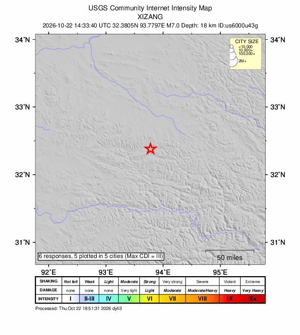
This USGS intensity map reflects reported shaking and modelled estimates; it is not a photograph of damage. Ground conditions, building materials and a structure’s distance from the rupture all shape what people experience. The confirmed casualties and structural damage therefore come from Chinese local and national authorities, not from the colour bands on a seismic map.
What remains uncertain
Authorities have not yet published a complete assessment of damaged homes, public infrastructure or displaced residents. Reports from inaccessible villages can arrive later, so the current toll should be treated as provisional. The immediate indicators to follow are whether search teams can reach the cut-off areas, whether communications and road links are restored, and whether medical facilities can continue treating people injured in the quake.
The earthquake is separate from the deadly August floods along the Nepal–Tibet border. For readers following the wider regional recovery, CrispNG’s earlier report on those floods covers that distinct disaster.
Image credit: The featured USGS ShakeMap and inline intensity map are United States Geological Survey materials in the public domain.
Sources: China’s emergency management ministry update on casualties and response level; China State Council/Xinhua on the rescue order; USGS event record and ShakeMap; Associated Press reporting on road, rail and communications disruptions.