

What is causing the fresh flooding in Port Harcourt?

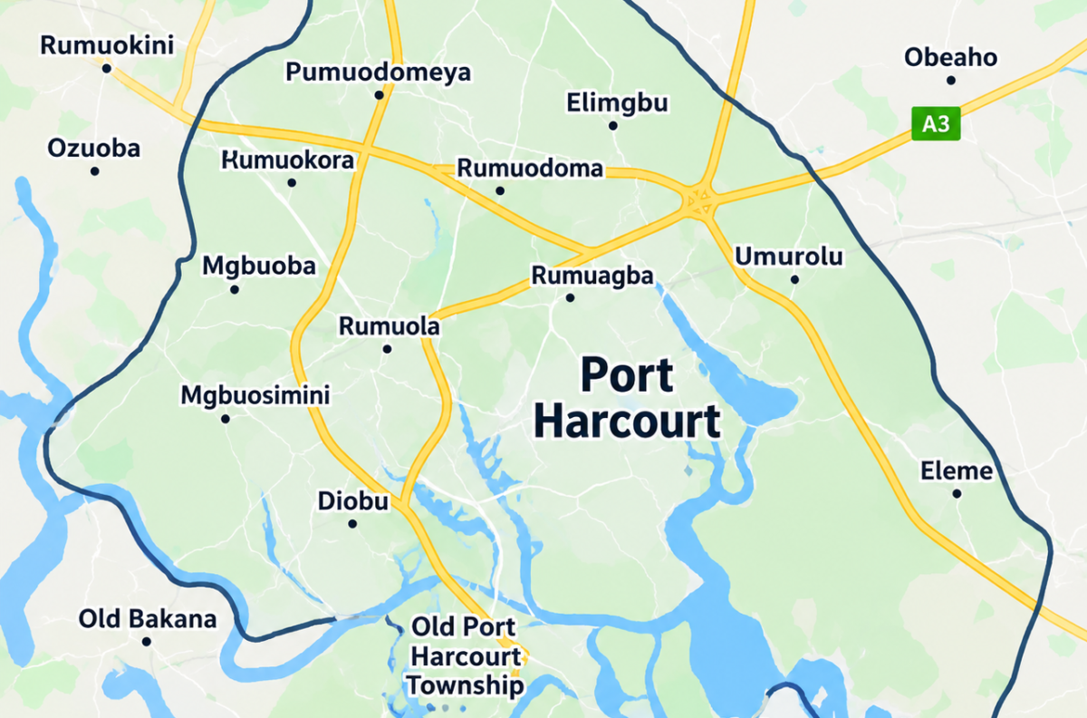
Several parts of Port Harcourt, Rivers State, have been hit by flooding after days of persistent rainfall, leaving roads, homes, businesses and other properties affected.
The latest flooding has been reported in areas including New GRA, Eliozu, Eneka, Elimgbu, Odili Road, SARS Road, Rukpokwu and parts of the wider Port Harcourt area. Other reports also identified Rumuokwuta, Obiwali Road, Aba Road, Ozuoba and NTA Road among affected locations.
But what exactly is behind the fresh flooding, and was there any warning before the situation worsened?
Port Harcourt flooding: Persistent rainfall
The immediate trigger for the latest flooding is the persistent heavy rainfall recorded across the city over several days.
Reports from Port Harcourt show floodwaters entering homes and business premises, while several roads became difficult or impossible to use. Some residents were also reported to have moved household belongings to safer locations as water levels rose.
The continuing rainfall has meant that areas already struggling to drain accumulated water have had little opportunity to recover before more rain arrives.
Port Harcourt flooding: NiMet had issued a flash-flood risk warning
The rainfall did not come without a broader weather warning.
The Nigerian Meteorological Agency (NiMet) published a probable flash-flood risk map for September 21–30, 2026, warning of areas susceptible to flash flooding during the third dekad of September. The agency said the product was designed to identify areas where rapid surface runoff and flash-flood occurrences could become more likely.
NiMet also issued a weather bulletin on September 26 covering September 27–29. Its broader forecasts for southern Nigeria included the possibility of thunderstorms and rainfall during the period.
This means the heavy rain responsible for the latest flooding occurred during a period when the country’s meteorological agency had already identified elevated weather and flash-flood risks.
Port Harcourt flooding: Drainage and blocked waterways
Heavy rainfall alone does not necessarily explain why floodwater remains on roads and enters properties.
Reports from residents have raised concerns about blocked drainage channels, inadequate drainage capacity, waste and encroachment on waterways.
One resident quoted in a report called for the desilting and widening of major drains, clearing of blocked waterways and culverts, adequate water outlets and regular maintenance. Another resident blamed some of the flooding on construction and development around waterways. Those are residents’ assessments rather than independently established findings from an official investigation.
The combination of intense rainfall and drainage systems that cannot quickly move excess water away can increase the severity and duration of urban flooding.
Port Harcourt flooding: Waste can worsen drainage problems
Another issue raised in reports from the affected communities is the presence of refuse and sewage in floodwater.
Where waste accumulates in drains and waterways, it can obstruct the movement of rainwater and contribute to water backing up onto roads and surrounding properties.
Reports from the latest flooding have also raised concerns about sanitation and possible health risks because of the mixture of floodwater, refuse and sewage.
However, the presence of waste should not automatically be treated as the sole cause of the flooding. The available reports point to several contributing factors, including rainfall, drainage capacity and development around waterways.
Port Harcourt flooding: Which areas are affected?
Reports from September 28 identified several affected locations across Port Harcourt and nearby parts of Rivers State.
They include:
- New GRA
- Eliozu
- Eneka
- Elimgbu
- Rukpokwu
- SARS Road
- Peter Odili Road
- Rumuokwuta
- Obiwali Road
- Aba Road
- Ozuoba
- NTA Road
The effects have varied from one location to another, with reports of flooded roads, homes, businesses, estates and other facilities.
Port Harcourt flooding: Why the problem keeps returning
The latest incident also fits a wider pattern of flooding reported in Port Harcourt during periods of heavy rainfall.
Earlier in September, heavy rain also caused flooding and traffic disruption around locations including Rukpokwu, Ozuoba, NTA Road and other parts of the city.
The recurrence means the issue cannot be explained simply by one day’s rainfall. The severity of individual flooding events can be influenced by rainfall intensity and duration, drainage infrastructure, the condition of waterways, land development and waste management.
For the current incident, however, persistent rainfall is the immediate trigger, while drainage and waterway-related factors have been raised as possible contributors.
Port Harcourt flooding: What should residents do?
NiMet has advised residents in areas affected by thunderstorms and rainfall to take precautions, including avoiding flooded roads and remaining alert in low-lying and flood-prone areas.
Residents should avoid attempting to drive or walk through rapidly moving or deep floodwater, particularly where the condition of the road underneath cannot be seen.
As the rainfall continues, residents in vulnerable areas should also monitor official weather and emergency advisories and move to safer locations when necessary.
The latest flooding has once again brought attention to the need for both immediate assistance for affected residents and longer-term measures to improve drainage, protect waterways and reduce flood risk across Port Harcourt.