Will Hurricane Erin affect UK? What residents can expect amid August Bank Holiday
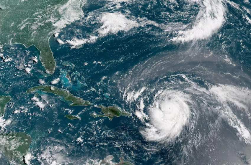
Hurricane Erin, which is the first hurricane of the 2025 Atlantic season and has developed into a dangerous Category 4 hurricane, moves westward near Puerto Rico in a composite satellite image on Saturday. Cira/NOAA/Reuters
As millions in England, Wales and Northern Ireland look forward to the August Bank Holiday, attention has turned to the Atlantic, where Hurricane Erin has been dominating weather headlines. Some outlets have claimed that Britain could be hit by a “600-mile wall of rain.” But experts stress that this phrase is misleading, and that Erin’s impact will be far more typical of what the UK usually experiences when tropical systems lose strength over the ocean.
What’s Happening With Hurricane Erin?
Erin recently intensified into a Category 4 storm, producing hazardous surf and rip currents along the US East Coast. The storm is currently impacting the Bahamas and Turks and Caicos, where tropical storm warnings remain in place. Though powerful, Erin is not expected to make landfall in North America. Instead, as it moves across the North Atlantic, it will gradually weaken and transition into an ordinary low-pressure system.
Will the UK See a “Wall of Rain”?
Meteorologists say no. BBC weather presenter Simon King explained that the term comes from a misinterpretation: the weather system associated with Erin will likely span hundreds of miles, but that doesn’t mean solid rain will fall continuously across the entire area. Instead, expect scattered bands of wet and breezy weather typical of late-summer Atlantic systems.
Timing for the UK
Any remnants of Erin are unlikely to affect Britain until the middle of next week, well after the August Bank Holiday. Forecast models suggest unsettled conditions could develop by Wednesday or Thursday, bringing periods of rain and gusty winds. However, confidence in the details remains low at this stage.
Bank Holiday Forecast: Mostly Fine
The good news is that high pressure will dominate through the Bank Holiday weekend itself. Settled weather will prevail across most of the UK, with only the odd light shower possible in northern regions. Daytime highs will range from 18–22°C in much of the country, climbing to 24–25°C in parts of central and southern England. Northern Scotland will be cooler at around 17–19°C, but still largely dry.
Festivalgoers at Reading and Leeds, or families making the most of the long weekend, are unlikely to see major disruptions. By Monday, temperatures are set to climb further, with many parts of southern Britain enjoying conditions above the seasonal average.
Looking Ahead
Once Erin’s remnants arrive, the picture could shift toward wetter, breezier weather. Still, such ex-hurricane systems are not unusual for the UK in late August. With summer 2024 already tracking toward one of the warmest on record, a spell of unsettled conditions would be more of a seasonal reset than a dramatic washout.