Severe storms sweep Georgia: Tornado watch issued as damaging winds, flooding rain and school delays hit the region
Severe storms trigger tornado watch across central Georgia
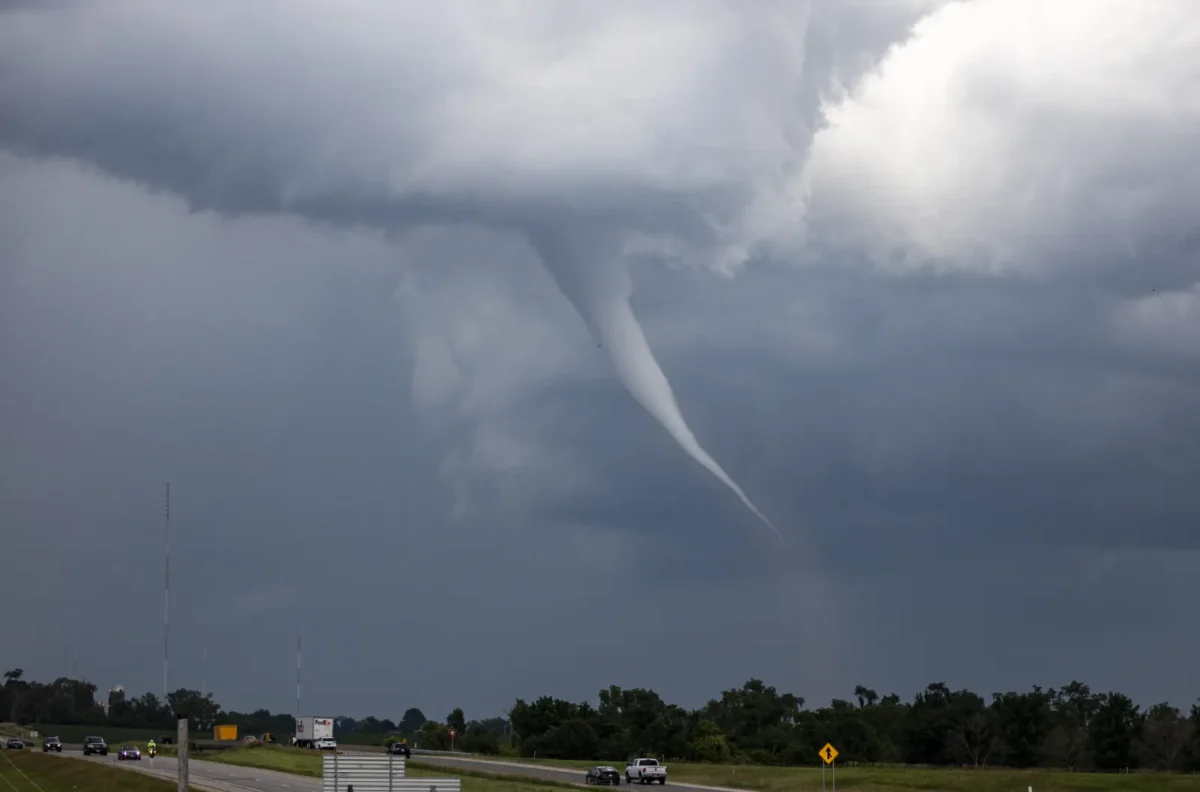
A powerful line of severe thunderstorms sweeping across Georgia early Thursday has prompted meteorologists to issue a tornado watch covering several counties in the central and eastern parts of the state.
According to the National Weather Service, the watch remains active through the morning as the storm system moves eastward, bringing the risk of damaging wind gusts, heavy rainfall, lightning, and isolated tornadoes.
Forecasters warn that the severe weather system could disrupt morning commutes, cause localized flooding, and create hazardous conditions for residents across affected communities.
Tornado Watch Remains Active in Central and East-Central Areas
Meteorologists say the tornado watch continues for more than 20 counties in central parts of the state as the storm line progresses east.
Cities such as Macon, Warner Robins, and Milledgeville remain within the watch zone, where conditions are considered favourable for tornado development.
The watch area also includes communities like Cordele, Forsyth, and Hawkinsville.
Weather officials note that a tornado watch means atmospheric conditions are capable of producing tornadoes, though one has not necessarily been detected.
Residents are encouraged to stay alert and monitor weather alerts as conditions can change quickly.
Storms Moving at 35 MPH With Damaging Wind Potential
Meteorologists tracking the system report that the thunderstorms are moving eastward at approximately 35 miles per hour, carrying the potential for wind gusts reaching up to 60 mph.
Such winds can cause tree damage, power outages, and structural damage to roofs and siding.
In addition to high winds, the storms may produce:
- Small hail
- Frequent lightning
- Heavy rainfall
- Localized flooding
Weather radar earlier detected conditions that briefly triggered a tornado warning in parts of western Georgia, though the warning expired after the immediate threat subsided.
Despite that, experts warn the severe weather threat remains significant while the storm system continues moving across the region.
READ ALSO
Fire weather watch: Dangerous fire conditions threaten Florida Counties — here’s what to know
Tornado Watch Cancelled in Several Counties
As the storm system advanced eastward, the National Weather Service cancelled the tornado watch in several north-central and west-central counties.
Areas including Columbus, Peachtree City, Griffin, and Newnan are no longer under the alert as the strongest part of the storm moved away.
Forecasters say the shift in the watch area reflects the eastward progression of the storm line, with the greatest risk now concentrated in central and eastern counties.
School Districts Announce Delays Amid Severe Weather Threat
Several school districts implemented two-hour delays Thursday morning due to the severe weather threat.
Local education officials said the precaution was necessary to ensure student safety while the storm system moved through the region.
School buses in affected districts began operating two hours later than normal, with administrators confirming that breakfast programs would still be available for students upon arrival.
Despite the delayed start, most districts said dismissal times would remain unchanged.
Authorities stressed that safety decisions were made based on weather forecasts indicating the potential for severe storms during early morning travel hours.
Flooding and Lightning Risks Remain Possible
Even in areas where tornado threats have decreased, meteorologists warn that heavy rainfall and lightning remain concerns.
Localized flooding could occur in neighborhoods experiencing prolonged downpours, especially in low-lying or poorly drained areas.
Drivers are urged to exercise caution on the roads, as intense rainfall can quickly reduce visibility and lead to dangerous conditions.
Emergency officials recommend that residents:
- Stay indoors during severe storms
- Avoid flooded roadways
- Monitor official weather alerts
- Prepare for potential power outages
Severe Weather Threat Expected to Gradually Weaken
Forecasters say the severe weather threat should gradually diminish later Thursday morning as the storm system continues moving eastward.
However, residents are still advised to remain vigilant until all watches and warnings are lifted.
Weather experts emphasise that tornado-producing storms can develop quickly, making real-time weather updates critical for public safety.
FAQ
What is happening with the weather in Georgia today?
Severe thunderstorms are moving across the state, prompting a tornado watch in several central and east-central counties. The storms may bring damaging winds, heavy rain, lightning, and isolated tornadoes.
What does a tornado watch mean?
A tornado watch means weather conditions are favorable for tornadoes to form. It does not mean a tornado has been confirmed, but residents should stay alert and be prepared.
How is a tornado warning different from a tornado watch?
A tornado warning means a tornado has been detected by radar or spotted on the ground. A watch means tornado formation is possible based on atmospheric conditions.
Which areas are under the tornado watch?
More than 20 counties in central and eastern parts of the state are under the tornado watch, including several major communities in the region.
What dangers are associated with the severe storms?
The storms may produce wind gusts up to 60 mph, heavy rainfall, lightning, small hail, and isolated tornadoes. Flooding may also occur in areas experiencing intense rainfall.
Why did some schools delay classes?
Several school districts delayed classes by two hours to allow the severe weather to pass before students traveled to school, ensuring safer transportation conditions.
Can heavy storms cause flooding even without a tornado?
Yes. Intense rainfall from severe thunderstorms can overwhelm drainage systems and lead to localized flooding, especially in low-lying areas.
When will the severe weather threat end?
Meteorologists expect the storm system to weaken later in the morning as it continues moving east, but residents should still monitor updates until the watch expires.