Storm Chandra set to batter the UK with 75mph winds, flood risk and travel disruption
Storm Chandra Brings Severe Wind and Rain. Image Source: BBC Weather Watchers/MattFacey
The UK is preparing for severe wind and rain as Storm Chandra approaches, with the Met Office issuing multiple amber and yellow weather warnings ahead of its arrival on Tuesday. The storm, officially named by the Met Office, is expected to bring damaging winds, widespread heavy rainfall, coastal flooding and travel disruption, compounding the impacts of an already turbulent January.
Storm Chandra becomes the third named storm this month, following Storms Goretti and Ingrid, both of which caused significant damage across parts of the country. Meteorologists warn that the lack of recovery time between storms has left the UK particularly vulnerable to flooding and wind-related damage.
Amber Wind Warning Issued for Northern Ireland
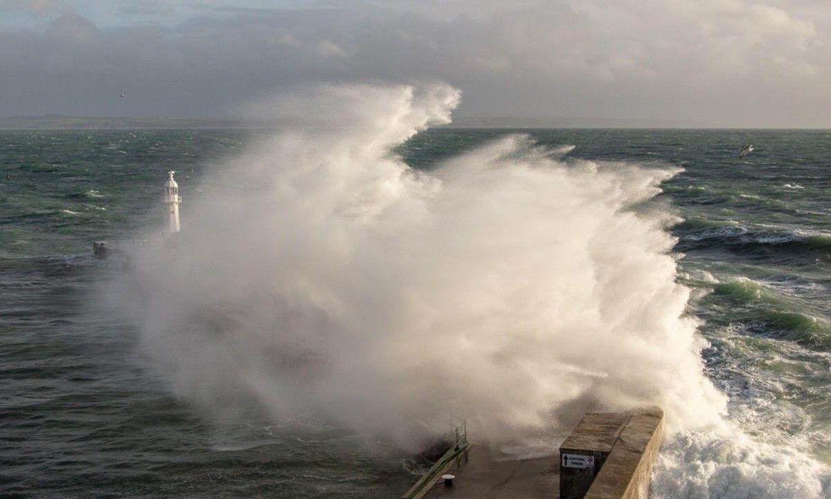
An amber wind warning has been issued for eastern parts of Northern Ireland, coming into effect from 05:00 until 21:00 on Tuesday. Forecasters say wind speeds could reach 75mph (120km/h) in exposed coastal areas.
These powerful gusts are expected to generate large coastal waves, with a high likelihood of waves overtopping sea walls and promenades, posing risks to infrastructure and public safety.
South-West England Faces Amber Rain Warning
In addition to the wind threat, the Met Office has issued an amber rain warning for south-west England, effective from 17:00 on Monday until 09:00 Tuesday.
Rainfall totals of 30–50mm are forecast across wide areas, with 60–80mm possible over higher ground, particularly south Dartmoor. With soil already saturated from previous storms, officials warn that flooding is increasingly likely, especially near rivers and low-lying communities.
READ ALSO
Snow in Florida? Rare winter weather stuns the Sunshine State as freezing temps linger
Yellow Warnings Widespread Across the UK
Beyond amber alerts, several yellow weather warnings have been issued across much of the UK:
- Northern Ireland: Persistent rain and flood risk, with up to 40mm over hills
- South-west England and Wales: Heavy rain, with up to 80mm over Dartmoor, Exmoor and the Brecon Beacons
- South-east England: Rainfall of 15–25mm, with higher totals over elevated areas
- Northern Ireland (Tuesday): Further wind warnings with gusts up to 70mph
The Met Office notes that yellow warnings, while the least severe, still indicate potential travel disruption, flooding and power outages.
Why Flood Risk Is Especially High This Time
Storm Chandra arrives after an exceptionally wet January, with many parts of the UK already recording more than double their average monthly rainfall. Rivers are swollen, drainage systems are strained, and groundwater levels remain high.
Meteorologists warn that the persistent nature of Chandra’s rainfall, combined with already weakened flood defences, significantly raises the risk of surface water flooding and river overflow.
Strong Winds Add to Structural and Power Risks
High winds remain a major concern. Previous storms have already weakened trees, buildings and power lines, particularly in south-west England. As a result, even moderately lower wind speeds could cause fallen trees, flying debris and power outages.
Transport operators are monitoring conditions closely, with the potential for train cancellations, road closures and ferry disruptions.
Why the Storm Is Named Chandra
Storm Chandra was named through a collaboration between the UK Met Office, Met Éireann and the Dutch KNMI. Storms are named when they are forecast to cause medium or high impacts, helping improve public awareness and safety communication.
Storm names are selected annually and released each September, following alphabetical order. Chandra follows Amy and Bram, with Dave, Eddie and Fionnuala next on the list.
FAQ
What is Storm Chandra?
Storm Chandra is a named weather system forecast to bring severe wind and heavy rain to the UK, triggering multiple weather warnings.
When will Storm Chandra hit the UK?
Storm Chandra is expected to affect the UK from late Monday into Tuesday, with peak impacts on Tuesday.
Which areas are most affected by Storm Chandra?
Northern Ireland, south-west England, Wales and parts of south-east England are expected to experience the worst conditions.
How strong will winds be during Storm Chandra?
Wind gusts could reach 75mph in exposed coastal areas, particularly in Northern Ireland.
Is flooding likely with Storm Chandra?
Yes. Heavy rain falling on already saturated ground significantly increases the risk of river and surface flooding.
Why are there amber weather warnings for Storm Chandra?
Amber warnings indicate a high likelihood of severe impacts, including danger to life, travel disruption and damage to property.
Could Storm Chandra cause power cuts?
Strong winds and weakened infrastructure increase the risk of power outages, especially in exposed regions.
How long will Storm Chandra last?
The worst conditions are expected to pass by late Tuesday, though residual flooding and disruption may continue.