South Africa weather: Where will thunderstorms hit this weekend? What residents should know
Weekend weather in South Africa: Cold mornings, mild sunshine ahead. Photo: Sandiso Phaliso
The South African Weather Service (SAWS) has cautioned residents across the country to prepare for a wet and stormy weekend, with widespread showers and thundershowers forecast for most provinces. A Yellow Level 2 weather warning has been issued for severe thunderstorms over parts of the North West province, expected to bring heavy rain, hail, and potentially damaging winds.
According to the latest forecast, weather conditions between Friday and Sunday will be shaped by two dominant systems — a trough positioned over the western interior and a high-pressure ridge extending over the eastern regions of South Africa. This atmospheric setup is anticipated to trigger isolated to scattered thundershowers across much of the country.
While most provinces will experience rainfall, the Northern Cape is expected to remain largely dry, with forecasters predicting minimal precipitation and persistent hot, windy conditions. In contrast, the eastern and northeastern regions — including parts of Gauteng, Mpumalanga, Limpopo, and KwaZulu-Natal — can expect repeated bouts of thunder and lightning, accompanied by cooler daytime temperatures.
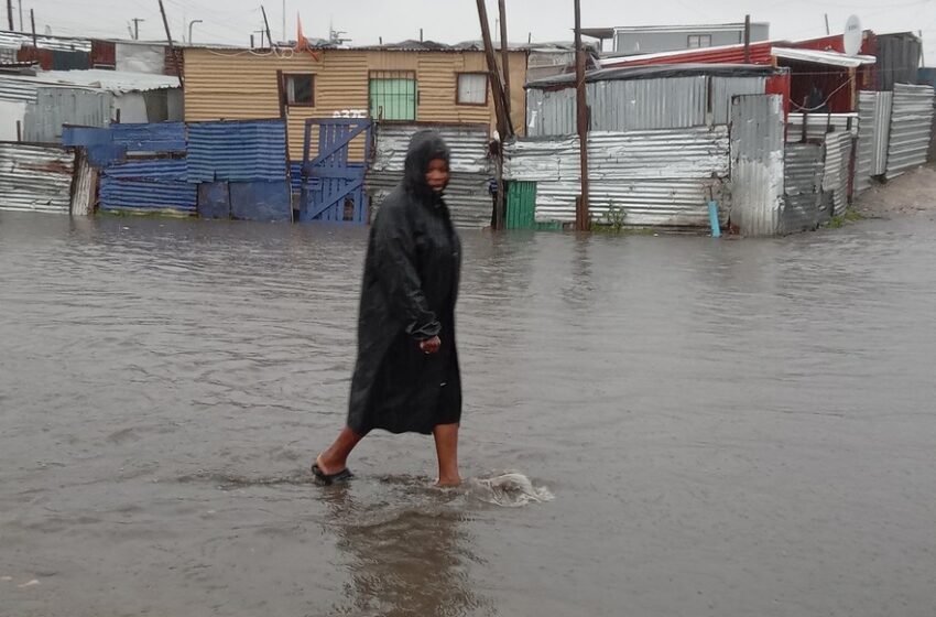
The weather service has urged residents of the eastern and central North West to remain cautious, as the anticipated storms could result in localized flooding in low-lying areas, waterlogged roads, and overflowing bridges. The severe weather conditions may also bring hail and strong gusts, posing a threat to vehicles, infrastructure, and outdoor activities.
SAWS emphasized that the Yellow Level 2 alert serves as a warning for potentially hazardous conditions that could cause localized disruptions. Citizens are advised to stay updated through official communication channels and avoid traveling during periods of heavy rainfall if possible.
Beyond the storm warnings, extreme fire danger conditions are predicted for several regions, particularly over the Northern Cape, western and central North West, western Free State, northwestern Eastern Cape, and northern parts of the Western Cape. The combination of strong winds, low humidity, and dry vegetation raises the risk of runaway veld fires in these areas.
Weather experts say the current pattern of alternating heat and heavy rainfall reflects South Africa’s seasonal transition toward early summer, where convective storm activity becomes more pronounced. Residents are encouraged to secure outdoor items, monitor local forecasts, and take precautions against sudden weather changes.
Temperatures across most regions are expected to range from cool to warm, with afternoon highs varying between the low 20s and mid-30s depending on location. Despite the unsettled conditions, SAWS does not foresee widespread severe flooding or prolonged storm systems beyond the weekend.
Authorities continue to advise the public to remain alert, especially in flood-prone zones, and to report blocked drains or infrastructure damage to local municipalities to minimize risks.
FAQ Section
1. What is a Yellow Level 2 weather warning?
It’s a moderate alert issued when weather conditions pose localized risks, such as flooding, wind damage, or hail.
2. Which provinces will be most affected?
The North West, Gauteng, Mpumalanga, and parts of the Free State and KwaZulu-Natal are expected to experience thunderstorms.
3. Will the Northern Cape experience rain?
No, most of the Northern Cape will remain dry, with high fire danger conditions instead.
4. What should residents do during severe thunderstorms?
Stay indoors, avoid metal objects, and refrain from crossing flooded roads or low-lying areas.
5. When will the weather improve?
Conditions are expected to stabilize by late Sunday, with clearer skies forecast early next week.