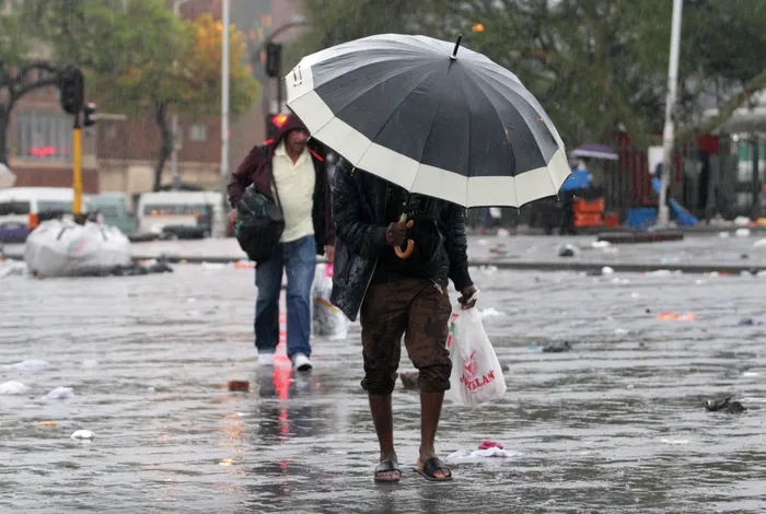
The South African Weather Service (SAWS) has issued its latest nationwide forecast for Monday, 22 December, warning of widespread rainfall, severe thunderstorms in several provinces, and extreme fire danger in parts of the country.
According to the forecast, conditions will range from cloudy to partly cloudy across much of South Africa. Isolated to scattered showers and thundershowers are expected over western and central regions, while widespread rainfall is forecast for eastern areas. Temperatures will generally be cool to warm, although hot conditions are anticipated in the western parts of the country.
Weather Warnings for Monday, 22 December
Impact-Based Warnings
SAWS has issued an orange level 5 warning for disruptive rainfall over the northern and eastern parts of Limpopo. This rainfall could lead to flooding of formal and informal settlements, roads, and low-lying bridges, with possible damage to mud-built structures.
A yellow level 4 warning for disruptive rain has also been issued for northern Mpumalanga and south-western Limpopo, excluding the extreme south-east. Similar impacts, including flooding and infrastructure damage, are expected.
Additionally, a yellow level 4 warning for severe thunderstorms has been issued for Gauteng, extreme south-western Limpopo, southern Mpumalanga, eastern North West, eastern Free State, and western KwaZulu-Natal. These storms may bring heavy rainfall, intense lightning, strong winds, and hail.
Another yellow level 1 warning applies to the north-central parts of the Northern Cape, where severe thunderstorms could result in localised flooding, damaging winds, excessive lightning, and hail.
Fire Danger
Extremely high fire danger conditions are expected over western parts of the Northern Cape and in some areas of the northern Western Cape.
Heat Advisories
SAWS has also warned of extremely hot and uncomfortable conditions in parts of the Namakwa District in the Northern Cape, as well as in sections of the Western Cape, excluding the south coast and adjacent interior.
Provincial Forecast
Inland Provinces
Gauteng:
Cloudy with cool to warm temperatures and widespread showers and thundershowers. UVB sunburn index: Moderate.
Mpumalanga:
Cloudy and cool to warm with widespread showers and thundershowers.
Limpopo:
Cloudy and cool to warm conditions with widespread rainfall and thunderstorms.
North West:
Cloudy and cool to warm with isolated to scattered showers, becoming widespread in the east.
Free State:
Cloudy and cool to warm with scattered to widespread showers and thundershowers, though isolated in western areas.
Coastal Provinces
Northern Cape:
Morning fog along the coast, otherwise partly cloudy and warm to hot with isolated to scattered showers. Fine conditions are expected in the extreme west. Coastal winds will be moderate to fresh westerly to south-westerly.
Western Cape:
Fog patches along the west coast in the morning. Elsewhere, conditions will be fine and warm to hot, becoming very hot in the eastern interior. UVB sunburn index: Extreme. Residents are advised to limit prolonged sun exposure.
Eastern Cape (Western Half):
Partly cloudy and warm to hot, with isolated showers in the extreme east. Coastal winds will strengthen from moderate to strong easterly in the afternoon.
Eastern Cape (Eastern Half):
Partly cloudy and warm to hot with scattered showers and thundershowers, isolated in the far south-west. Coastal winds will be fresh to strong north-easterly.
KwaZulu-Natal:
Cloudy with cool to warm temperatures and scattered showers, becoming widespread in the west. Coastal winds will be moderate to fresh northerly to north-easterly. UVB index: High.
Seasonal Outlook
SAWS notes that South Africa’s summer rainfall regions—including Gauteng—have already received significant rainfall this season, with wet conditions expected to persist.
In its Seasonal Climate Watch, which covers January to May, SAWS predicts above-normal rainfall for most summer rainfall areas during late summer and early autumn. This pattern is largely linked to the developing La Niña climate phenomenon.
However, forecasters caution that below-normal rainfall may occur along the southern and eastern coastal regions during autumn, a period when these areas typically receive substantial rainfall.
While dam levels across many provinces are currently healthy and the outlook supports a strong maize crop, SAWS warns that excessive rainfall could reduce yields. Minimum temperatures are expected to remain above average, though forecasts for maximum temperatures later in the season remain uncertain.
Residents are advised to remain weather-aware, especially during the festive period, as the risk of flash flooding remains elevated in several regions.