Severe thunderstorms put millions in Northeast USA on high alert
Severe storms sweep the Northeast with threats of flash flooding, damaging winds, and hail.
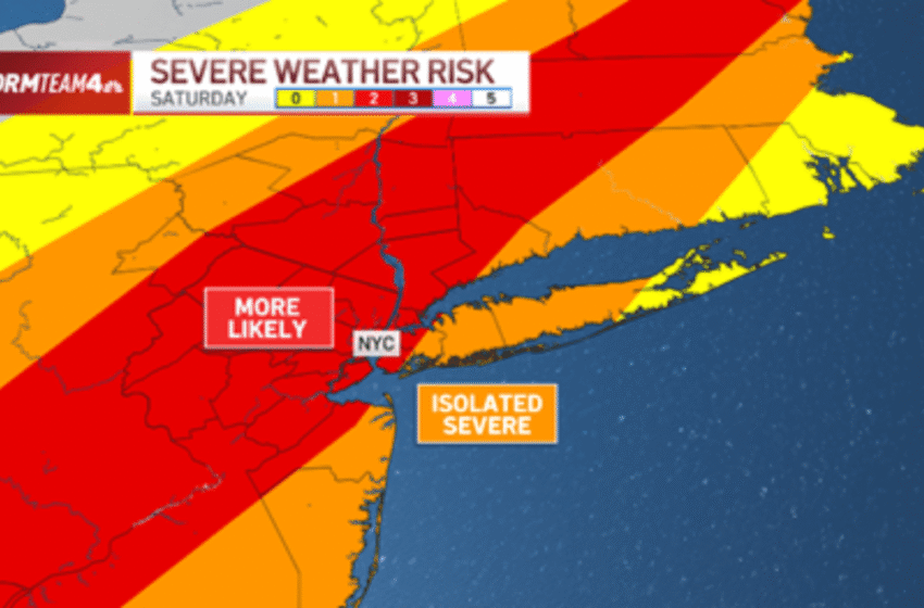
Warnings and Watches in Effect
The National Weather Service (NWS) has issued a Severe Thunderstorm Watch extending from Maryland to Maine until 8 p.m. Along the busy I-95 corridor, cities including Baltimore, Philadelphia, New York City, and Boston remain at risk.
What to Expect
- Damaging wind gusts up to 60 mph
- Large hail capable of property damage
- Frequent lightning creates power outage risks
- Isolated tornadoes, particularly in northern New England
- Flash flooding in urban and low-lying areas from torrential rain
Slow-moving storms with heavy downpours could lead to flooding in Philadelphia, Bridgeport, and surrounding areas, where rainfall rates may exceed two inches per hour.
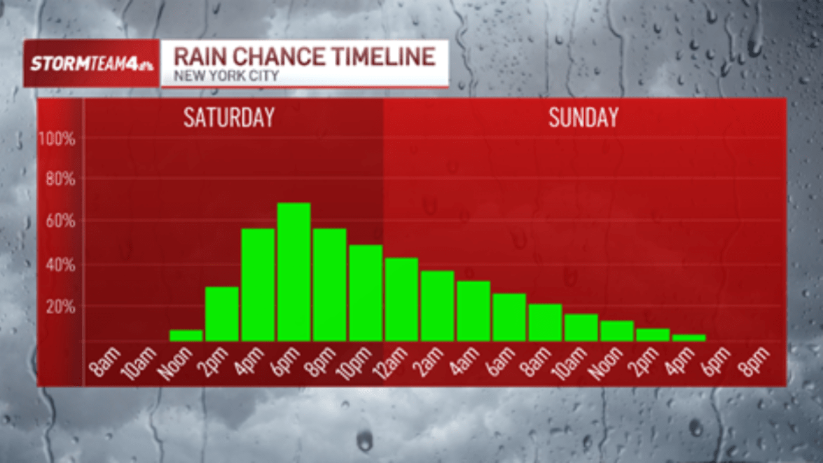
Timeline of Storms
Philadelphia to New York City: 2–8 p.m.
Poughkeepsie, Hartford, Springfield: 2–8 p.m.
Portland to Boston: 4–10 p.m. with overnight rain
Thunderstorms first erupted in Texas on Friday, forcing the postponement of a high school football game. By Saturday afternoon, the cold front had sparked storms across the Hudson Valley and New Jersey before pushing into metro New York City.
Local Impact
New York City emergency officials urged residents to seek shelter immediately, warning of flying debris, downed trees, and power lines. Travel could become dangerous during the heaviest rainfall, with flash flooding possible on poorly drained roads.
Outlook
Storms are expected to taper off late Saturday night into Sunday morning. By Sunday afternoon, drier and cooler air will settle in behind the front, offering some relief before high pressure brings clearer skies early next week.