Is San Francisco at risk of Tornado on Christmas? Bay Area faces rare severe storm threat
Severe storm system brings flood and tornado risk to San Francisco
San Francisco woke up to emergency alerts, flash flood warnings and dangerous winds as a powerful storm system swept through the Bay Area during the early hours of Christmas Day. Meteorologists are warning that the weather threat is far from over, with rare tornado-favorable conditions, damaging wind gusts and heavy rainfall expected to linger throughout the holiday.
According to the National Weather Service and newsroom meteorologists, this storm stands out not just for its intensity, but for its structure, a key factor driving concern across San Francisco and surrounding counties.
Flash Flood Warning Issued for San Francisco and San Mateo County
A flash flood warning was issued for San Francisco and northwestern San Mateo County until 6 a.m. Christmas Day, triggering emergency alerts to residents’ phones. The alert warned of a “dangerous and life-threatening situation”, advising people not to travel unless evacuating from flooded areas.
Heavy rainfall rates of up to one inch per hour were possible, raising the risk of urban flooding, overwhelmed drainage systems and landslides in vulnerable areas.
READ ALSO
Where did 4.3 earthquake strike in San Francisco Bay Area?
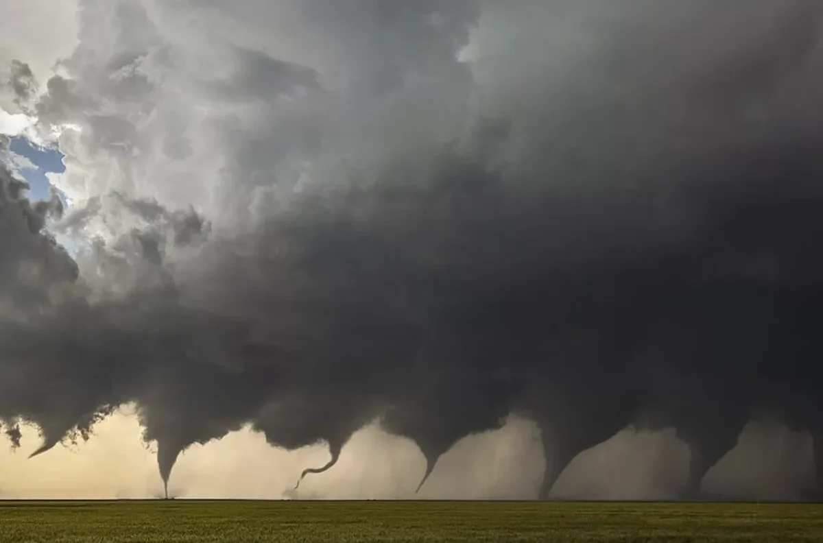
Why This Storm Is Different: Meteorologists Flag Tornado Risk
What alarmed forecasters most was not just the rain, but the organization of the storm cells. High-resolution weather models showed storms forming as separate, rotating cells, rather than a single disorganized band of rain.
This setup allows storms to rotate more easily, increasing the likelihood of supercells, the type of storms most capable of producing brief tornadoes or damaging wind gusts.
An experimental AI-based forecasting tool, Nadocast, highlighted parts of the North Bay as having an elevated tornado risk during the early Christmas morning hours.
When and Where Tornado Risk Is Highest in the Bay Area
According to the National Weather Service, the highest tornado risk stretches along the immediate California coast, including San Francisco, from approximately 11 p.m. Wednesday to 5 a.m. Thursday. Coastal areas from Point Arena to Monterey are included in the zone of concern.
While the chance of a tornado striking any single location remains low, meteorologists stress that the risk is unusually high for the Bay Area, making vigilance critical.
Damaging Winds Pose the Greatest Threat
Wind is considered the most dangerous aspect of the storm, according to National Weather Service meteorologist Dylan Flynn.
- High wind warnings are in effect for coastal areas, including San Francisco, with gusts reaching 65 mph
- Wind advisories inland forecast gusts up to 55 mph, including Oakland and San Jose
- Warnings remain active until 10 a.m. Christmas Day
These winds increase the likelihood of downed trees, power outages and flying debris, particularly in coastal neighborhoods.
Heavy Rain, Flooding and Landslide Concerns Continue
While strong winds may help storms move quickly, repeated rounds of thunderstorms could compound flooding risks, especially if multiple cells pass over the same area.
Meteorologists warn that urban flooding and landslides are possible, particularly in hillside neighborhoods and areas with saturated soil from previous storms.
How Long Will the Storm Last in San Francisco?
Forecasters say storm conditions will peak overnight, but rain, wind and scattered thunderstorms are expected to linger throughout Christmas Day.
“It’s a totally separate system, but it’s going to feel almost identical,” Flynn said, noting that residents should prepare for another night of severe conditions even if they slept through earlier impacts.
Safety Advice for San Francisco Residents
Meteorologists urge residents to:
- Charge phones overnight to receive emergency alerts
- Keep phones near the bed
- Avoid unnecessary travel during warnings
- Stay indoors during high wind periods
Flooding and fallen trees remain a greater overall risk than tornadoes for most residents.
FAQ
Is there really a tornado risk in San Francisco?
Yes. Meteorologists say conditions are favorable for brief tornadoes or waterspouts, especially along the coast, though the risk remains low at any specific location.
Why was a flash flood warning issued in San Francisco?
Intense rainfall rates combined with saturated ground created a risk of rapid urban flooding, prompting emergency alerts.
What is the biggest danger from this storm?
Damaging winds pose the greatest threat, with gusts exceeding 60 mph capable of downing trees and power lines.
How long will bad weather last in San Francisco?
Stormy conditions are expected to linger through Christmas Day, with multiple waves of rain and wind.
Should people travel in San Francisco today?
Travel is discouraged during warnings, especially in flood-prone areas or during peak wind periods.
Are tornadoes common in the Bay Area?
No. Tornadoes are rare in the Bay Area, which is why meteorologists are paying close attention to this system.
What should residents do to stay safe?
Stay indoors, keep phones charged, monitor alerts, and avoid flooded roads or outdoor activities during high winds.