Will a massive Blizzard shut down New York? Tri-State braces for historic snowstorm
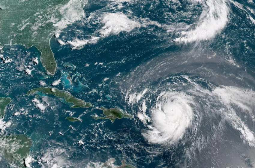
Hurricane Erin, which is the first hurricane of the 2025 Atlantic season and has developed into a dangerous Category 4 hurricane, moves westward near Puerto Rico in a composite satellite image on Saturday. Cira/NOAA/Reuters
Millions of residents across the U.S. Northeast are preparing for what forecasters say could be the region’s most disruptive winter storm in years. Meteorologists warn a powerful coastal system will bring blizzard conditions, heavy snow, damaging winds, and widespread travel chaos from Sunday afternoon through Monday morning.
The warning covers New York City and surrounding areas across New Jersey, Long Island, Connecticut and parts of Pennsylvania — a region commonly known as the Tri-State area.
Rare Blizzard Threat After Nearly a Decade
The National Weather Service has issued blizzard and winter storm warnings across the region, describing the storm as both dangerous and potentially life-threatening.
Forecasters expect between 12 and 18 inches of snow across a broad swath, with localized totals exceeding 20 inches in heavier bands. The storm is also notable for its weight — the snow will be wet and dense, increasing the risk of structural damage and fallen trees.
If projections hold, it would be the most significant snowstorm to hit New York City since the record-breaking January 2016 blizzard. The last time the region experienced official blizzard warnings was in 2017, making this a relatively rare event.
Dangerous Winds and Whiteout Conditions
Weather experts warn snowfall alone is not the main threat — powerful winds could create extreme hazards.
Gusts may exceed 50 mph overnight Sunday into Monday morning, combining with heavy snowfall to produce whiteout conditions where visibility drops below a quarter mile for several hours.
Officials caution that:
-
Travel could become impossible
-
Trees and power lines may collapse
-
Large-scale power outages are likely
-
Coastal flooding may reach 2.5 to 3 feet at high tide
Because the storm’s atmospheric pressure may rival that of a Category 2 or 3 hurricane, meteorologists expect a rapid intensification phase as cold air crashes into the system.
Timeline: When the Storm Will Hit
Saturday: Calm conditions with clouds and temperatures in the mid-40s — final preparation window.
Sunday Morning: Light snow begins; early flakes may melt initially due to above-freezing temperatures.
Sunday Afternoon: Temperatures drop; steady accumulation begins.
Sunday Night – Monday Morning: Peak impact — snowfall rates up to 2–3 inches per hour, strong winds, near-zero visibility.
Monday Midday: Snow gradually tapers but winds remain strong.
Tuesday: Cold temperatures with snow cover lingering.
Midweek: Gradual thaw expected.
Government Warnings and Emergency Measures
Authorities are urging residents to remain indoors once conditions deteriorate. The mayor of New York City advised citizens to stay off roads unless absolutely necessary and check on neighbors.
Meanwhile, New Jersey has declared a state of emergency ahead of the storm. Officials also warn that flight cancellations and public transport shutdowns are likely.
Schools, offices, and medical facilities may temporarily close during the peak of the storm due to dangerous conditions.
What Residents Should Do Now
Emergency officials recommend preparing for at least 72 hours of disruption:
-
Stock three days of food and water
-
Charge phones and backup batteries
-
Prepare flashlights and blankets
-
Gather medications and first aid supplies
-
Avoid travel Sunday evening through Monday morning
The agency warns that peak snowfall and strongest winds will overlap — creating slippery roads, immobilized vehicles and potentially life-threatening exposure outdoors.
A Storm That Could Define the Winter
While snowstorms are common in the Northeast, forecasters stress this one stands apart due to the combination of snowfall intensity, hurricane-force winds, and coastal flooding risk.
For many residents, the safest plan is simple: stay indoors and wait it out.
FAQ
How much snow is expected?
Most areas may receive 12–18 inches, with some spots exceeding 20 inches.
When will the worst conditions occur?
Late Sunday evening through early Monday morning.
Will flights be cancelled?
Yes. Widespread delays and cancellations are likely.
Why is this storm dangerous?
Heavy snow combined with strong winds creates whiteouts, power outages and impassable roads.
What is a blizzard warning?
Sustained winds over 35 mph plus blowing snow reducing visibility below a quarter mile for at least three hours.