Hurricane Erin update: Forecast sees huge storm moving closer to US — what to know
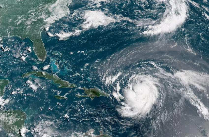
Hurricane Erin, which is the first hurricane of the 2025 Atlantic season and has developed into a dangerous Category 4 hurricane, moves westward near Puerto Rico in a composite satellite image on Saturday. Cira/NOAA/Reuters
Hurricane Erin continues to track toward the Eastern Seaboard, prompting evacuation orders and states of emergency in parts of North Carolina as forecasters warn of flooding, rip currents, and high surf.
As of Tuesday evening, Erin was located about 615 miles south-southeast of Cape Hatteras, N.C., moving north-northwest at 10 mph. The storm carried maximum sustained winds of 105 mph — weaker than Monday’s 140 mph peak but still strong enough to cause significant impacts. Meteorologists expect Erin to regain some strength and expand in size over the coming days.
Although Erin is not forecast to make direct landfall in the United States, its massive wind field is already creating dangerous conditions. Forecasters say waves could reach 15 to 20 feet along the coastline, with storm surge flooding of two to four feet possible in low-lying areas. A tropical storm warning has been issued for the Outer Banks, while a storm surge warning covers the stretch from Cape Lookout to Duck.
Evacuations are underway on Hatteras and Ocracoke Islands, where rising water has begun creeping onto Highway 12 — the only road link for many communities. Local officials are urging residents and visitors to leave before conditions worsen.
From Florida to Long Island, residents are being cautioned about life-threatening rip currents and dangerous surf. Even communities far from Erin’s projected path are likely to feel its effects, as the hurricane is producing tropical-storm-force winds up to 230 miles from its center.
Experts say the storm’s size, rather than its current wind speed, poses the biggest threat. Wide-reaching surge and beach erosion are expected as waves batter the coastline. “The size of the storm really is correlated with higher storm surge levels over larger swaths of area,” noted Matthew Janssen, a coastal hazards researcher.
Erin is the first hurricane of the Atlantic season, and while it is expected to curve away from the U.S. coast later this week, its impacts will linger. The system briefly reached Category 5 status last weekend before weakening, a rapid intensification that scientists warn is becoming more common in a warming climate.
Communities across the East Coast are being advised to stay alert, follow evacuation orders where issued, and monitor forecasts as the storm moves northward.