Hurricane Erin: Areas that will be hit by big waves and coastal flooding
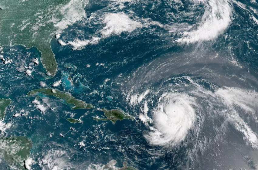
Hurricane Erin, which is the first hurricane of the 2025 Atlantic season and has developed into a dangerous Category 4 hurricane, moves westward near Puerto Rico in a composite satellite image on Saturday. Cira/NOAA/Reuters
Communities from Florida to New England are bracing for treacherous surf, coastal flooding, and travel disruptions as Hurricane Erin moves northward in the Atlantic.
As of Wednesday morning, the storm remained a powerful Category 2 system, packing sustained winds of 110 mph. Meteorologists say Erin will not make landfall in the United States but will pass at its closest point through Thursday, lingering offshore after spending more than a week churning across the ocean.
The threat, however, lies in the storm’s size. Its tropical storm–force winds stretch 265 miles from the center, generating swells that will radiate nearly 1,000 miles. This means beaches and low-lying areas from Florida to Canada’s Newfoundland could see pounding surf, rip currents, and pockets of coastal inundation from Wednesday through Friday.
Authorities in several states have urged residents and visitors to heed local warnings. Some beaches have posted red flags restricting swimming, while officials in flood-prone zones are monitoring tide cycles closely for potential storm surge.
Satellite imagery shows Erin as a sprawling, well-organized hurricane with a massive wind field. Forecasts indicate the system will gradually weaken as it tracks northeast into cooler waters, but its impact will linger across the coastline in the form of hazardous marine conditions and beach erosion.
Travelers are advised to check for local weather alerts and exercise caution around coastal areas until the storm fully pulls away from the region.