Cascadia mega-tsunami: What Americans in the Pacific Northwest need to know
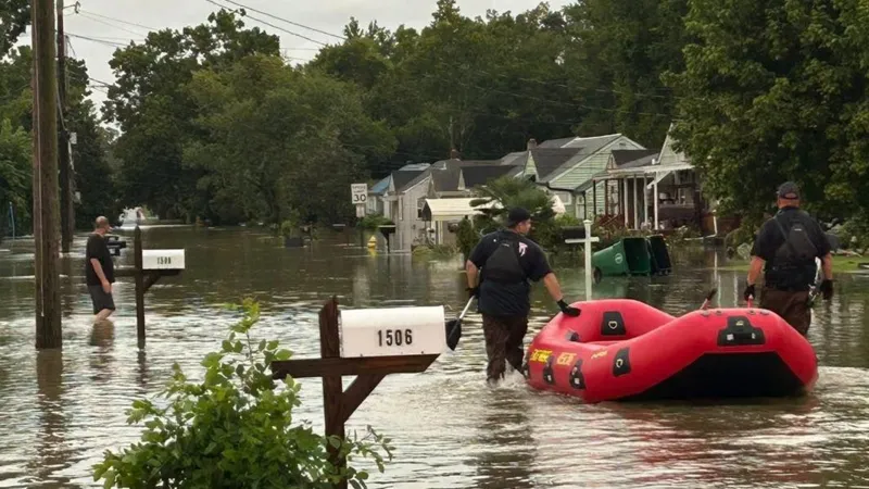
Flash floods in Tennessee leave three dead, one missing as rescuers battle historic rainfall in Chattanooga and surrounding areas.
Scientists are warning that one of America’s most dangerous fault lines, the Cascadia Subduction Zone, poses a looming threat of a massive earthquake and tsunami that could devastate communities along the Pacific Northwest. Stretching from Northern California through Oregon and Washington, the fault has the potential to unleash a disaster that would put millions of U.S. residents at risk.
Where is the Cascadia Subduction Zone?
The Cascadia Subduction Zone (CSZ) is a 600-mile offshore fault line that begins off the coast of Northern California, runs past Oregon and Washington, and ends near Vancouver Island in Canada. It is a tectonic boundary where the Juan de Fuca Plate is being forced under the North American Plate. Over centuries, stress builds until it is violently released in the form of a massive earthquake. When this occurs, the shaking can last several minutes and often triggers a destructive tsunami. The last time this fault ruptured was in 1700, an event so powerful that the resulting tsunami reached the shores of Japan. Scientists agree that another rupture is inevitable.
How Likely is a Major Cascadia Earthquake?
Estimates from the U.S. Geological Survey suggest there is a 10–14 percent chance of a full-margin magnitude 9.0 earthquake in the next 50 years. The odds rise to about 37 percent for a partial rupture along the southern segment, which would primarily impact Northern California and Oregon with an event in the range of magnitude 8.0 to 8.6. These probabilities make the Cascadia Subduction Zone one of the most significant natural disaster threats in the United States.
READ ALSO
Cascadia mega-tsunami threat: Millions at risk along US Pacific Coast — all to know
Which U.S. Areas Are Most at Risk?
The danger zone covers nearly the entire U.S. Pacific Northwest coastline. Oregon communities such as Seaside, Newport, and Coos Bay face some of the highest tsunami risks. In Washington, places like Long Beach, Westport, Ocean Shores, and Aberdeen are especially vulnerable. In Northern California, towns including Crescent City and Eureka would likely see the tsunami arrive within minutes. While inland cities such as Portland and Seattle are outside the direct inundation zones, they remain at high risk for severe earthquake damage, transportation disruption, and supply shortages.
What a Cascadia Tsunami Would Look Like
If the Cascadia fault ruptures, the first waves could strike the U.S. coastline in as little as 10 to 30 minutes. These would not appear as single towering walls of water but as a series of surges, each capable of sweeping miles inland. Wave heights could reach several tens of feet, powerful enough to demolish buildings, roads, and bridges in coastal communities. At the same time, sections of the coastline could permanently sink by three to six feet, instantly altering shorelines and increasing flood depth. Researchers estimate that more than 30,000 lives could be lost, over 170,000 buildings destroyed, and damages exceeding $80 billion in the most severe scenarios.
What Americans Can Do to Stay Safe
Residents of Oregon, Washington, and Northern California must understand the natural warning signs. If you feel strong shaking that lasts for several minutes, struggle to stand upright, or notice the ocean suddenly draining or roaring, you must treat these as immediate tsunami alerts. Do not wait for official warnings. The safest response is to move inland or uphill without delay.
Preparedness starts with knowing your evacuation zone. State agencies in Oregon, Washington, and California provide detailed tsunami evacuation maps. Every household should walk their evacuation route and practice reaching high ground on foot, as roads may be impassable. Families should prepare a go-bag with essentials such as water, food, flashlights, medications, documents, and sturdy shoes. Supplies for children, the elderly, and pets must also be included. Coastal residents should keep these kits in accessible locations.
Community Preparedness in the U.S.
Several U.S. towns, such as Westport in Washington, have already constructed vertical evacuation towers designed to give residents a safe refuge above expected flood levels. More structures are planned across the region, and communities are encouraged to advocate for their development. Annual earthquake and tsunami drills, including the Great ShakeOut, are widely promoted across the United States and help residents practice their response. Community sirens, signage, and local drills are also vital tools in keeping populations alert and ready.
U.S. Warning Systems
The United States operates ShakeAlert, an earthquake early warning system in California, Oregon, and Washington. While it provides only seconds of warning, it can alert people to take protective action before shaking intensifies. For tsunami-specific alerts, the National Oceanic and Atmospheric Administration (NOAA) issues warnings through phone alerts, radio, sirens, and emergency systems. A tsunami warning means dangerous flooding is expected, and residents in low-lying zones must remain evacuated until authorities declare the area safe.
The Cascadia Subduction Zone is often called America’s sleeping giant. Scientists cannot predict the exact day or year it will rupture, but they are certain that it will. For people living in coastal Oregon, Washington, and Northern California, survival depends on preparedness and rapid response. If you live, work, or vacation in these areas, remember this rule: if the ground shakes hard and long, head to high ground immediately. Your life could depend on it.